Inaccurate topographies of territorial states
Yelta Köm
CATEGORY
“On a larger scale, such visible and invisible infrastructures can legitimise the implantation of security and tracking tools in cities, ultimately accelerating dispossession and oppression.”
The modern state looks at the world from a bird’s eye view, divides it into pieces, and regulates it in a subject hierarchy. It aims, furthermore, to change perception through surveillance tools and create new secure zones in physical environments. On a larger scale, such visible and invisible infrastructures can legitimise the implantation of security and tracking tools in cities, ultimately accelerating dispossession and oppression.
Maps are a collection of visual images that construct information, spatialise data, and are believed to be accurate and precise. Since Babylon is more advanced today, drawings construct our relationship with the planet in different forms. The history of the maps progresses in tandem with the means of war and control.
It shows historical commonality with the existing plan drawing in the architectural narrative, especially because of the point of view, looking from the place where it is possible to overlap. In Donna Haraway’s words, the “God Trick” called the view of the map from the eyes of God has similar characteristics to the view of the architect to the ground and the soil. The history and formation of the maps are interwoven with colonial practices. Mercator, one of the world’s most frequently used map projections, provided the most useful solution to seafarers while also building neo-colonial routes.
With the development of computer-based mapping systems since the 1950s, it has begun to leave its mark while constructing the spatial narrative. Different calibration systems and satellites worldwide have turned the planet into a digital surveillance object. The spatial distribution of these traces that will be left to the post-human future of the planet consists of traces etched into the soil.
It is important to think about these systems within the development of digital mapping bound together with historical, military, and defense industry interests and funding, often backed by nationalist motivations.
It has essential roles, especially regarding colonising and new initiatives that alter and change a community or society of any size. Cartographic representation and power relations are always bound together, and states use maps as a tool for maintaining authority—because of this, in today’s world, this relationship becomes increasingly more complex and intertwined as time passes.
In the history of modern states, maps and visual symbolism play a crucial role. Knowing that maps have a political role, it can be understood that the geopolitical imagination of nationalism reproduced itself through maps. Almost all common facets of nationalist ideologies use the map as a nationalist sign, which is separated from its surrounding geographical context and implies unity. There is a strong distinction between the nation and others, creating the illusion of a homogenous population.
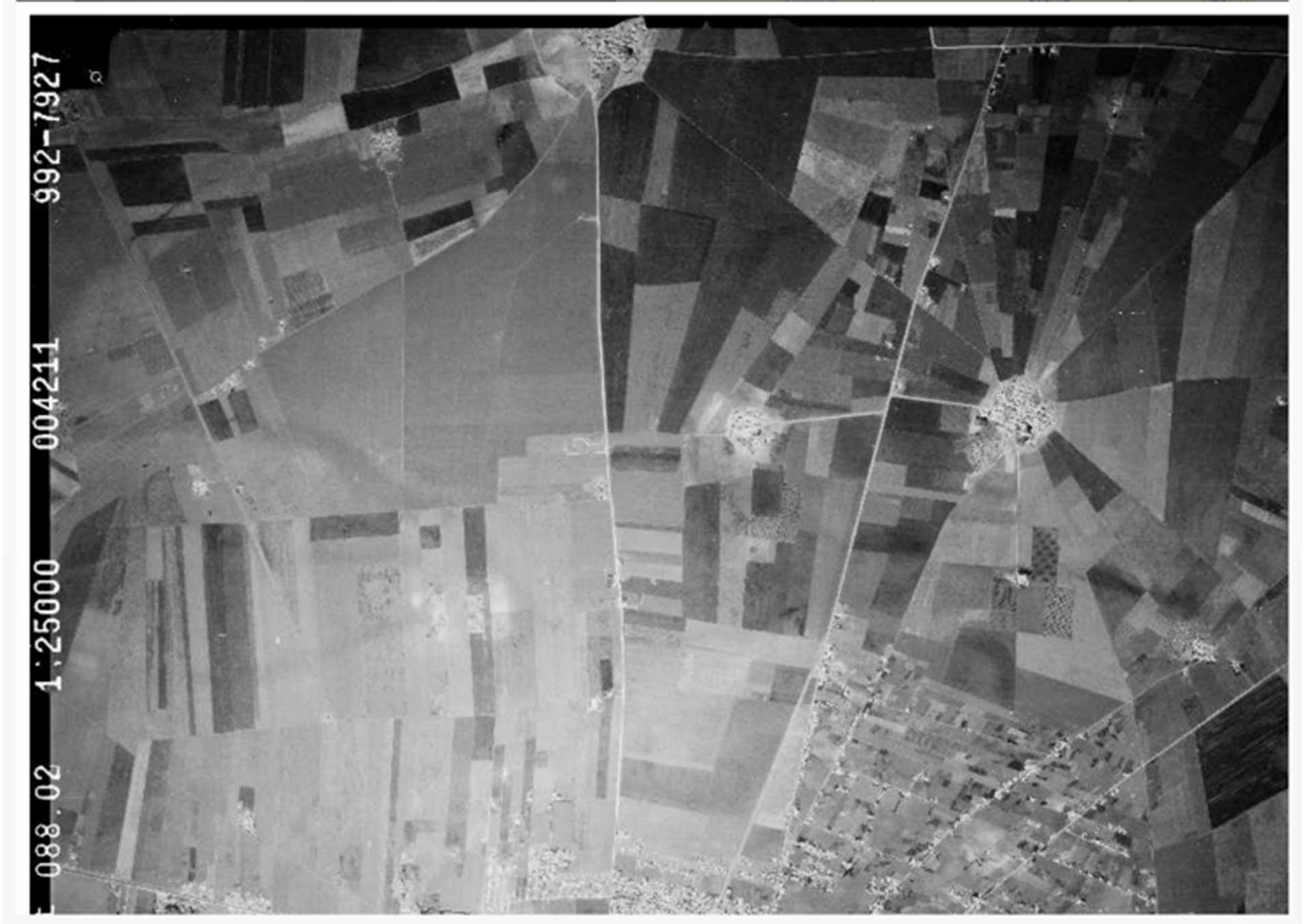
Research Images of Territorial Islands Project, Yelta Köm
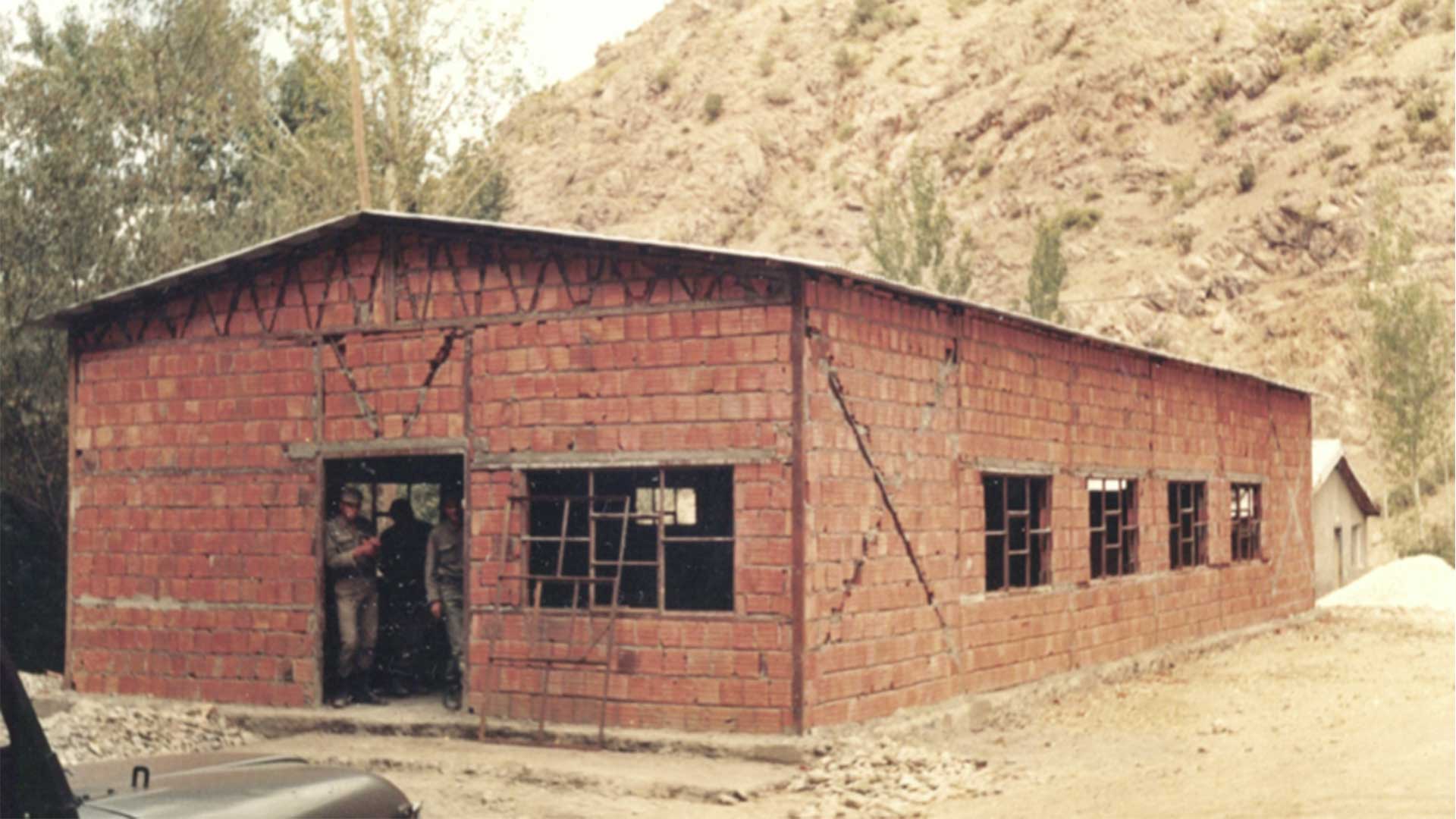
Archival material from personal records, Yelta Köm
Inaccurate topographies of territorial states is part of Urgent Pedagogies Issue#7: Entangled Topographies
is a Berlin based artist who brings together architectural, artistic, and spatial practices to discuss social and political issues. His work is centred around landforms, technology, critical approaches to environment and communities, urban surveillance methodologies, data mapping systems, architectural technologies, oral and cinematographic storytelling, and the questioning of representation techniques. He is a co-founder of Herkes İçin Mimarlık (Architecture for All), a non-profit organisation devoted to offering approaches to social problems in Turkey from an architectural perspective. Yelta Köm is currently working as a research associate and teaching at the Practices and Politics of Representation chair of Bauhaus Universität Weimar Faculty of Architecture.